top of page
Cost analysis
This demonstrates various steps on the path to determining the optimal routes from a point with a high density of children to the nearest sizable park.
-
Primary tools included spatial analyst suite; manual input of raster calculator and map algebra.
-
Click on images for expanded versions and further context.
Applying spatial analyst skills to local datasets
 Hot/cold spots of child densityThese demonstrate the statistically relevant locations of child density. |  SlopeThis depicts the general trends of slope change for each cell. (after revising the elevation rasters and generating a hillshade, previous full extents) | 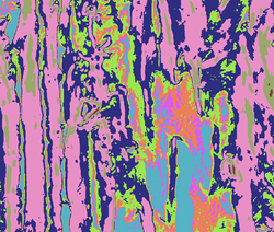 Slope reclass (zoomed in)This re-classified the slope raster to better represent it and match the other raster scales. |
|---|---|---|
 Road rasterThis converts the road lines into a raster format, to be considered in the raster calculations. It does introduce some flaws in cells being so large as to create confusion at some gaps where multiple road segments may be near one another. |  Euclidian DistanceThis takes a large cluster of those child density spots and draws the Euclidean distance (straight line/"as the crow flies") from its centroid. |  Distance reclassed (quantile)This reclassifies that distance in quantile format, which places a greater weight on the closer points. |
 Cost calculatedThis is one of the final steps required to produce the purple lines, after using raster calculator to weigh the relationship between the rasters representing roads, slope, and distance. |  BacklinksThese represent the "lowest cost" direction to travel from that given cell back to the source location. |  End product (zoomed in) |
 Full extent - Hillshade |  Full extent - Slope |  Full extent - Euclidian distance |
 Full extent - Distance (quantile) |  Full extent - CalculatedMultiplies out the cell values of each raster on a weighed scale (Road then slope then kid distance) and then indicates the total value with darker as lower values and lighter as higher. |  Full extent - Cost distance |
 dycl_image_11_backlink.png |
bottom of page